This afternoon a thunderstorm over southern Mississippi underwent an evolution that is often associated with tornado occurrence in thunderstorms. Whether or not a tornado developed remains to be seen, but the radar evolution was fairly classic. What do I mean?
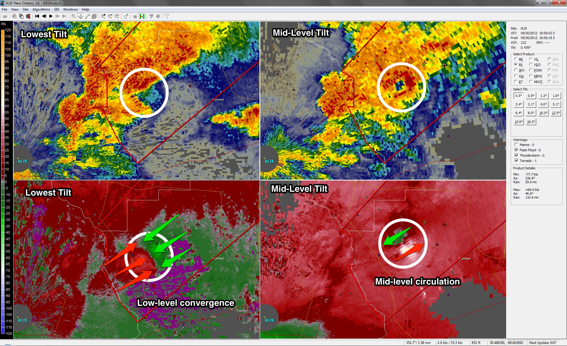
Consider the image above. The left panels are from the radar’s lowest tilt and the panels on the right are from a mid-level tilt. The top panels are radar reflectivity (which is what you typically see on television) and the bottom panels are of the doppler velocity (i.e., the wind speed and direction in a radial sense [towards or away from the radar]). [For orientation purposes, the radar site is located in the bottom left of the image, green values (in the velocity panels) are toward the radar, and red values (in the velocity panels) are away from the radar.] The mid-level pattern is similar to what one might conceptually think about with respect to identifying possible tornadoes on radar, meaning that a rotation signature is present. However, examining the lower-level tilts, we fail to find a rotational signature. Does this mean there is no tornado? Well, not-exactly…
Before continuing, let’s remind ourselves that a tornado is an extension of a thunderstorm’s updraft. By definition, an updraft is a area where air is ascending. Furthermore, the mass continuity equation dictates that if air is rising, there must be convergence at the base of the updraft. This means that in the presence of a developing tornado, you may not find a rotational couplet; instead you might find a convergent signature, which is exactly what we see in the radar image above.
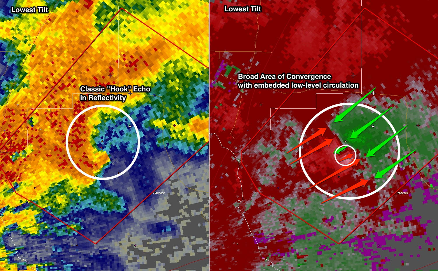
In the next radar scan (shown below), as the (possible) tornado continues to develop (and move farther away from the radar site), we notice that the broad, low-level convergence still persists. However, in this scan, one can notice the addition of a rotational couplet in the midst of the broad low-level convergence. If one were to continue to follow the evolution of this (possible) tornado, one would find that the low-level rotation signature persists for several more volume scans…all in the vicinity of the broader, low-level convergence.
So, what does this mean? When looking at radar data, it is important to examine the entire radar volume — not just the lowest tilts! Thunderstorms are very complex. What happens at low-levels typically plays a role in what happens in the upper-levels, and what happens in the upper-levels impacts what happens in the lower-levels.

